

More people, same land: Is St. Maarten planning for a future of people gridlock?

St. Maarten has spent decades attracting people, investment and opportunity, but there is one thing economic success cannot provide: more natural land. The country occupies approximately 13.1 square miles, and every home, hotel, road and public facility must find its place within those boundaries. The question is whether planning has kept pace.
The entire island shared with French St. Martin is commonly described as roughly 36 square miles, but the Dutch side occupies only about 34 square kilometres. According to the Department of Statistics (STAT), its population increased from 2,335 in 1930 to 41,902 in the 2022 Census, a rise of nearly 1,700%. Almost 40,000 additional residents came to occupy the same territory.
In 1930, St. Maarten had 68.7 residents per square kilometre, or about 178 per square mile. By 2022, density had risen to 1,232.4 per square kilometre, equivalent to about 3,192 people per square mile. That is an almost eighteenfold increase.
That transformation was anything but gradual. The population stood at 2,728 in 1960, jumped to 7,827 in 1972 and reached 13,156 by 1981. Then, during eleven years of rapid economic expansion, it climbed to 32,221 in 1992, an increase of 19,065 residents, or nearly 145%, from the 1981 count.
After declining to 30,594 in 2001, the count rose to 33,609 in 2011 and then to 41,902 in 2022. The most recent census therefore recorded 8,293 additional residents, an increase of 24.7% in eleven years, or an average net addition of roughly 754 people annually between those counts. Those figures show the cumulative change planners must accommodate.

More recent population estimates suggest that the pace has moderated. STAT estimated 42,449 residents as of January 1, 2025, only 547 more than the 2022 census count. Slower growth does not erase demands created by decades of expansion.
The census also shows that growth has shaped not just the number of residents, but the character of the population. Only 13,003 people, approximately 31.1%, reported being born on the Dutch side, while roughly two-thirds were born elsewhere. The largest reported places of birth outside St. Maarten included the Dominican Republic, with 3,977 residents, Haiti with 2,770, Jamaica with 2,531, and the French side of the island with 2,330.
These figures tell part of the story of a society built through movement across borders, with families, languages and economic connections extending throughout the Caribbean and beyond. They do not establish when each resident moved to the country, nor should birthplace be confused with nationality. Planning must therefore account for migration, births, deaths and established communities.
The distribution of those residents is just as significant as the total. STAT found that approximately 49% of the 2022 population lived in Cul de Sac and Lower Prince's Quarter, which works out to roughly 20,500 people in two census areas. That concentration matters for roads, drainage, schools and emergency access, which experience demand locally.
Nor is all of the country's 13.1 square miles equally available for development. Hillsides, coastal exposure, drainage corridors and existing construction narrow the options for placing new homes and public facilities. The gross density figure includes land that may be difficult, costly or unsuitable to build on, meaning the concentration of people in developed areas can be much higher than 3,192 per square mile.
The World Bank's 2021 assessment of St. Maarten's housing sector described scarce suitable land, expensive construction and unresolved land ownership issues. It also noted underdeveloped leased parcels and constraints on financing, demonstrating that vacant land on a map is not automatically land that can deliver housing. The location and type of development therefore matter nationally.
Housing demand is not determined by population size alone. The 2022 Census found that 31% of households consisted of one person, meaning the number of homes needed depends on how people live together as well as how many people live here. Single-person households can increase demand for separate housing units.
Affordability complicates matters further. In its 2021 assessment, the World Bank reported that the cheapest family houses on the market were priced above US$200,000 and remained beyond the means of up to 60% of residents under the conditions studied. Those are historical figures, not a measurement of 2026 prices, but they underline a persistent planning question: if development expands the building stock without meeting local incomes, who benefits from the additional space?
Neither taller buildings nor more subdivisions offer a complete answer. Higher-density residential projects can make efficient use of scarce land when water, electricity, wastewater systems, parking and road capacity are adequate. Without those provisions, adding housing may simply move the burden from a shortage of homes to overloaded neighbourhood infrastructure.

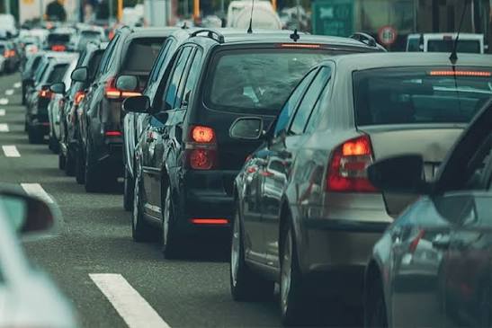
Residents encounter one possible symptom in traffic congestion, although census figures alone cannot establish its causes. The pressures on St. Maarten's roads also reflect vehicle ownership, school and work schedules, commercial activity, tourism and daily movement across the island. With relatively few major corridors and limited opportunities to construct alternatives, decisions about where people live and work matter as much as individual road projects.
Tourism adds demand that cannot be measured by the resident census. Visitors, rental vehicles, businesses and movement between the two sides all make use of roads and public services, sometimes at the same hours as residents commuting to work or school. A resident count of roughly 42,000 therefore understates total infrastructure use.
The pressure extends beyond traffic. New development requires dependable electricity, water, drainage, sewage arrangements and solid waste collection, while existing neighbourhoods still need maintenance and upgrades. Before approving major projects, government should be able to explain whether these systems have spare capacity, what upgrades are required and who will pay for them.
Population growth is only one part of the census story, because St. Maarten is also ageing. The median age rose from 35 in 2011 to 43 in 2022, while residents aged 65 and older increased from roughly 5% to 14% of the population. STAT counted approximately 5,669 people aged 65 or older in 2022, alongside 6,461 children under 15, a combination that demands thoughtful planning for both generations.
An older population may require more accessible housing, reliable transport, healthcare and support for people who cannot easily manage everyday activities. The census found that 35% of residents reported a long-term illness, while 22% reported some difficulty with activities such as walking, seeing or remembering. These figures make accessibility and healthcare capacity matters of infrastructure policy, not simply individual family concerns.
There is also evidence that residents' circumstances are far from uniform. Approximately 11%, or 4,600 people, lacked health insurance in 2022, even though coverage had improved substantially since 2001, when about 30% were uninsured. The census further found that 7% had experienced hunger during the previous year because they lacked money for food, a reminder that economic growth and rising property values do not automatically translate into security for every household.
None of this establishes that St. Maarten has reached its maximum sustainable population. Density is a useful warning signal, but it is not a capacity test: highly populated places can function well when housing, transport, public services and environmental safeguards are planned together. The real issue is whether St. Maarten knows how much additional development its available land and existing systems can reasonably support.
That question calls for more than a series of separate building approvals. It calls for an updated inventory of developable land, realistic population projections, neighbourhood-level infrastructure assessments and a clear account of where affordable housing and essential public facilities will go. The census should guide spending on roads, utilities, healthcare and elderly services.
The choices become harder once land is occupied. A parcel used for construction today may no longer be available tomorrow for a drainage channel, school, access road or community space, and the cost of fixing a planning mistake can be far greater than preventing it. St. Maarten therefore needs to judge projects not only by the jobs or investment they promise, but by the cumulative demands they create for the country around them.
The census records a remarkable story of transformation, from 2,335 residents in 1930 to more than 42,000 in the latest population estimate. The next chapter cannot be judged by population totals, building permits or economic activity alone; it must also be judged by whether residents can afford a home, reach work, receive care and rely on public services. The land is not getting any bigger, so the planning must get better.